Since March, we’ve been following a pretty strict physical distancing protocol. We’ve kept up our hiking and cycling activities locally, but we have only been seeing people either outside while maintaining our distance or online (aside from masked-up essential trips to get groceries, doctors, etc.). It has kept us healthy so far, but we have really missed seeing our family and friends, and we were going a bit crazy being around home all the time (we really like traveling, as you can see by this site!). So after much discussion about how to do it safely, we decided to take a fall road trip to distance-camp with Jennifer’s sister Alice (who was rock climbing in Nevada) and visit Jennifer’s friend Melissa in Sacramento. We decided we could do it reasonably safely by:
- Driving rather than flying
- Eating take-out or cooking at camp (not eating inside restaurants)
- Camping in our own campsite or staying in motels with exterior doorways
- Only going inside for quick bathroom breaks, grocery stores, and motel check-in
- Wearing nose/mouth coverings while inside
- Keeping our distance from people whom we either didn’t know or weren’t following similar protocols, even outside
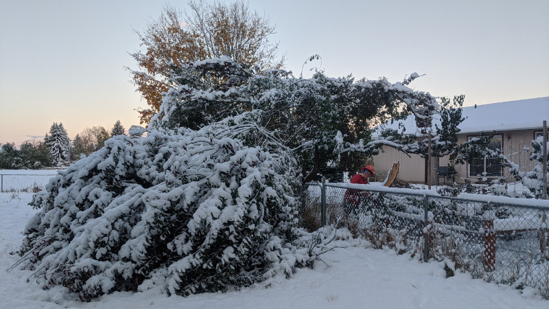
Our plan was to depart on Saturday morning, October 24, and we planned to start our trip by driving east to Missoula Montana, then go south through Idaho to camp at Craters of the Moon National Monument and Great Basin National Park on our way to Nevada. However, the day before we planned to leave, an unusual snow storm dropped 4″ of very wet, heavy snow on us, and then moved right over our planned route for Saturday, making driving hazardous. Plus, it was supposed to be about 5-10 degrees F (10-12 degrees below zero C) the first two nights of our trip, so camping wasn’t looking like it would be much fun. And that Saturday morning we woke up to a big mess: three big branches had fallen off one of our trees, two of them landing in our neighbor’s yard. It took us a few hours to clean it all up.
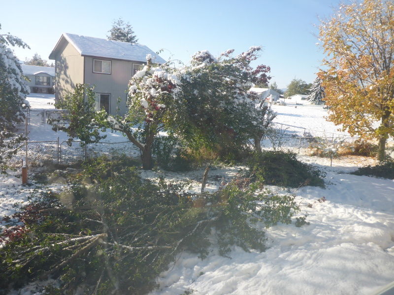
After we finished with at least moving the tree debris into our yard, we packed up the car around noon on Saturday and headed southwest instead of east (into better weather), making it as far as Burns, Oregon. The weather was cold there too, so instead of camping we opted for a cheap motel.
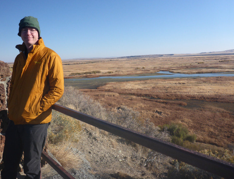
Sunday morning we went on the auto-tour route and a short hike in the Malheur National Wildlife Refuge near Burns.
After departing Malheur, we looked again at the weather and decided that instead of heading for Great Basin National Park (still very cold!), we would camp in Death Valley National Park, so we headed south and west. A bit south of Tonopah, Nevada, we came across a semi truck on its side across the highway (the wind was very strong there), which was completely blocking the road in both directions. It looked like it was going to take a while to get cleared out, so Zach looked at Google Maps and found a route that looked feasible for getting around the accident. It turned out to be composed of “roads” that were not much more than two sandy tracks, but we managed to get through in Jennifer’s little car, and we came out just past the accident. (Unfortunately, we didn’t take any photos!) We continued south, but by the time we got close to Death Valley, it was dark, the wind was still blowing very hard, and the road we had planned to take into the park was closed. We decided that the odds were stacked against us for camping, and opted for a motel in Beatty, Nevada.
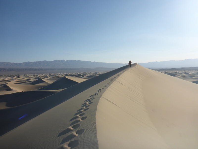
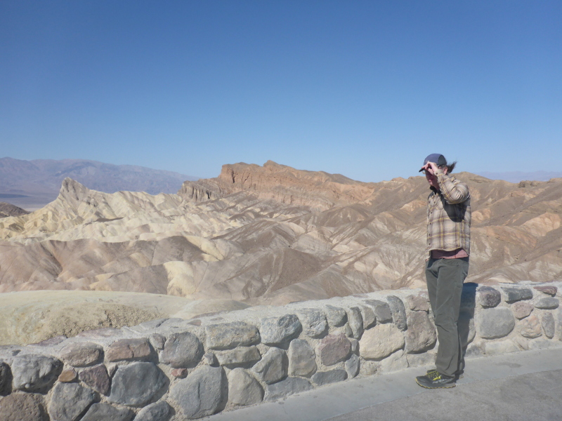
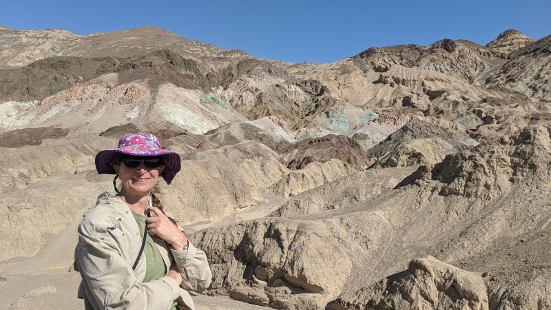
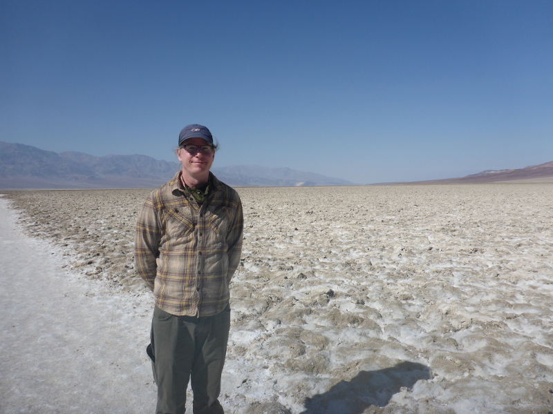
Monday we toured Death Valley, which is one of the hottest places on earth (late October is an ideal time to visit to avoid that!), and is filled with beautiful and strange scenery, including the lowest point in North America (282 ft/86 m below sea level).
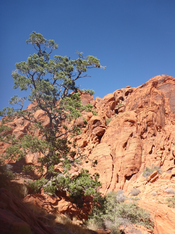
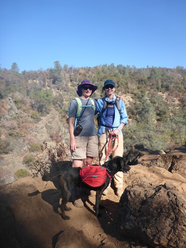
We left Death Valley in the late afternoon and headed over to Red Rock Canyon National Conservation Area in Nevada, where we camped for a few days, hiked, and visited (at a distance) with Jennifer’s sister Alice, her partner Paul, and some friends of theirs that they were rock climbing with.

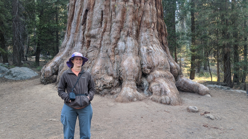
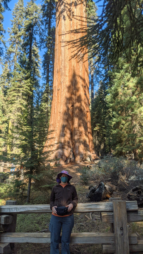
We left Red Rocks on Thursday afternoon (October 29), and headed to Porterville California for the night (at another cheap motel). The next morning, we drove through Sequoia and King’s Canyon National Parks, stopping for a couple of hikes, on our way to Jennifer’s friend Melissa’s house in Sacramento.

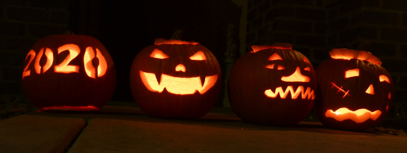
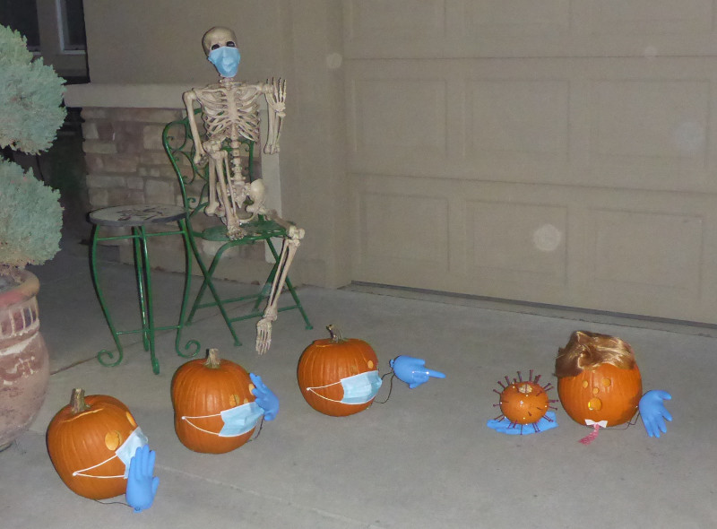
In Sacramento, we stayed (inside) with Melissa and her husband Curt for a few days of Halloween pumpkin carving, hiking, cooking together, and generally hanging out, rather than keeping our distance. This was undoubtedly the most COVID-risky part of the whole trip, but it was a huge mental health benefit for all of us to have a few days together, and as they follow similar protocols to ours, we all decided it was a small risk to take this one time.
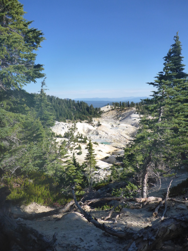
We left there on US election day, Tuesday November 3, headed for home. On Tuesday, we drove through Lassen Volcanic National Park, and went on a very lovely hike.
After touring Lassen, we drove through some very pretty fall colors to Bend, Oregon, where we camped in our tent outside of Jennifer’s sister Alice’s house for the night, and then returned home on Wednesday. For the trip, we drove nearly 3000 miles (4800 km) in Jennifer’s Toyota Prius C, averaging 49 mpg (4.8 l/100 km).
It sounds like a wonderful trip! I’m so glad you got a chance to travel and see friends and family. I loved seeing all the photos, especially Death Valley and the pumpkins. Glad you made it back!