We decided to do a bike tour at the end of the summer of 2014 on the International Selkirk Loop, which meant that we could leave and return from our front door. It sounded pretty nice, and we thought early September would be a good time for the trip. So in July, we sent off for the bicycling map of the loop, and started planning; we set off at the end of August.
Day 1: August 30, Otis Orchards WA to Sandpoint ID
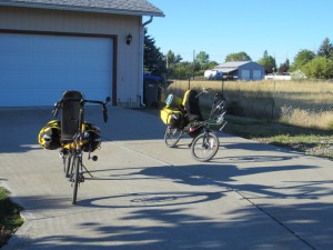
We set off from our house on the Saturday of Labor Day weekend. The weather was perfect for cycling. The first 12.5 miles to Rathdrum ID we had a good shoulder but quite a bit of 60MPH traffic whizzing by. After Rathdrum, we took some smaller roads to Athol ID, which were practically traffic-free and very pleasant, and we stopped for lunch at a diner there. At Athol, we had to get on US highway 95 for about 20 miles, which is very busy but luckily had a good shoulder. We were quite relieved at Sagle ID to get off the highway onto a bike trail that took us all the way into Sandpoint, even though the pavement on the trail was not in very good shape. We spent the night with our friend Beth. Total: 54 miles, mostly flat.
Day 2: August 31, Sandpoint ID to Bonners Ferry ID
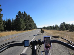
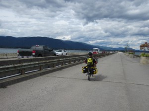
When we got up on Sunday, it was raining off and on, and it started raining really hard just as we were about to leave. So we waited a bit, and luckily after 15 minutes it was down to a drizzle, so we set off. We took side roads for the first 18 miles of riding, to avoid highway 95, and had some very quiet and pleasant riding at the expense of 3 miles on gravel, which was a good tradeoff — the rest was good pavement. There were a few hills, but nothing too long. Then we rode 11 miles on highway 95, which was again heavy with traffic but had a mostly OK shoulder. At Naples, we took the “Deep Creek” loop, which incidentally doesn’t have a sign saying Deep Creek Road — it just says it’s going to the Naples General Store (some other cyclists we met had missed the turn, which is too bad because it’s another very pleasant and quiet country road). A local driver even pulled off the highway in her car just as we were approaching the turn-off and waited for us, just to make sure we knew about this road, which was very nice. That took us pretty much to Bonners Ferry, which doesn’t seem very bike-friendly — someone even honked at us as we were riding into town, and 95 as it went into town didn’t have a shoulder for us to ride on. We camped at the Carriage House Inn and RV Park — very bike-friendly, and at $10 with showers it was the best bargain of the trip. We played Backgammon and Scrabble in the lobby, as it was a rainy evening; stayed dry for sleeping in our tent. Total: 40 miles, mostly flat with a few climbs of about 100-200 feet and some “rollers” (rolling hills). Trip odometer: 94.5 miles.
Day 3: Sept 1, Bonners Ferry ID to Creston BC
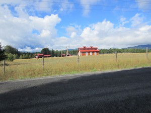
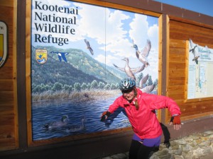
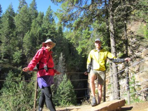
Monday morning, we rode out of Bonners Ferry towards the Kootenai National Wildlife Refuge, where we saw a moose crossing the road, and went for a couple of short hikes. Then we rode north on the West Side Road, Copeland Hill Road, and Farm to Market Road, which kept us off the main highway all the way to the US/Canada border. We rode about 8 miles total on gravel, but were rewarded by very quiet, pleasant country roads with almost no traffic. North of the border, we were on a relatively quiet highway into Creston, where we rode straight up (!) Erickson Street to Scotties RV Park, where we camped. (If we had known better, we would have circled around to the north end of town and come in on a flatter street.) Total: 41.5 miles, several hills but nothing too bad except the final climb into Creston. Trip odometer: 136.
Day 4: Sept 2, Creston BC to Crawford Bay BC
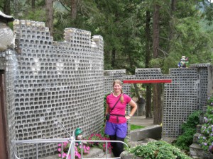
Tuesday morning we rode through Creston on a nice bike trail, and then headed out of town on highway 3A, which didn’t have much of a shoulder, but also didn’t have much traffic. Riding was fairly pleasant, with few sprinkles of rain and a few hills. We stopped to see the “Glass House”, which was a unique retirement project — a whimsical house built out of embalming fluid bottles — and camped for the night at the Kokanee Chalets in Crawford Bay, where it rained pretty hard all night. Total: 48.5 miles. Trip odometer: 184.6.
Day 5: Sept 3, Crawford Bay BC to Ainsworth Hot Springs BC
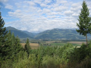
Wednesday we had a fairly short but steep day of riding. We rode out of Crawford Bay in the rain, and immediately started an 800 foot climb, followed by a similar descent to the Kootenay Lake ferry. A couple of other touring cyclists passed us on the way up the hill, and we spent much of the 45-minute free ferry ride drying out and chatting with them, as the weather cleared up. After the ferry ride, we fueled up at the bakery in Balfour, and then had a similar amount of up and down to reach Ainsworth Hot Springs, where we got a room in the Mermaid Lodge and Motel, which I had stayed in before as a kid when we went up there skiing at Christmas a few times. We hung up all of our wet stuff in the room, and went off to the hot springs to soak — lovely! Total: 14 miles of steep riding (plus ferry ride). Trip odometer: 198.3 miles.
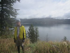
Day 6: Sept 4, Ainsworth Hot Springs BC to Ymir BC
Thursday first thing we had to retrace our route up and back down to the Balfour ferry terminal, where we enjoyed another stop at the bakery before heading west towards Nelson. Highway 3A there offers spectacular views, and the weather had cleared up, so we stopped at the Kokanee Creek Provincial Park for a picnic lunch. Nelson is a lively town filled with all kinds of people (tourists, buskers, etc.), and it’s built on the side of a very steep mountain, which made it a bit difficult to get around. We ended up pushing our bikes up several hills in order to reach the start of the Great Northern Trail, which we thought would be a good way to ride to Ymir. This trail is unpaved but not too rough; however, after the very strenuous climb to reach it, it was tiring — we should have just taken the highway, and at the first crossing we switched to the highway and rode on to Ymir. The trail appeared to get rougher after that point anyway. We camped in Ymir (primitive camping in the middle of the very small town), but should really have just stayed at the very cheap, historic, and quirky Ymir Hotel, where we had dinner. Total: 51 miles, lots of climbing. Trip odometer: 249 miles.
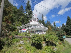
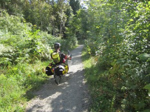
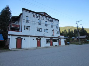
Day 7: Sept 5, Ymir BC to Sullivan Lake WA
Friday morning we woke up to a chilly morning with heavy dew, so we bundled up and rode out of Ymir towards Salmo BC; highway 6 was fairly quiet and had a good shoulder. We stocked up on groceries in Salmo, because we didn’t expect to see another grocery store for several days. After Salmo, highway 6 joins highway 3 for a while, which increased the traffic considerably, but there was still a good shoulder. After less than 10 miles, highway 6 split off again, which would have been good, except that the 6 miles from there to the US/Canada border were being chip-sealed, so instead of a nice quiet road with a good shoulder, we had to deal with road construction crews, dump trucks, gravel, the stink of fresh oil, pilot cars, and dust… but we had plenty of time, so we made it eventually. I got stung by a bee at the US border — through a couple of layers of clothes — but it didn’t hurt for long, and the border guards confiscated our oranges (depleting our breakfast food considerably!). South of the border, highway 31 was quiet, which was good because the shoulder was minimal to nonexistent for much of the way. Just north of Metalline Falls, we turned off on the Sullivan Lake road, and rode about 5 miles to the ranger station, where we camped. Total: 40.5 miles, some hills. Trip odometer: 289.5 miles.
Day 8: Sept 6, Sullivan Lake WA
Saturday we did trail work with my dad and some other volunteers led by Jane Baker from the Washington Trails Association (which is why we camped for free at the ranger station and not at the campground). We were doing “tread work”, which means widening and flattening out a trail that had not been maintained for a few years, and clearing out brush that had overgrown the trail. The trail we were working on was the “Shedroof Divide” trail, which we’ve backpacked on before — beautiful area, so it made the frequent breaks lovely. Spent another night at the same place.
Day 9: Sept 7, Sullivan Lake WA to Newport WA
Sunday we bid goodbye to my dad, Jane, and the rest of the WTA volunteers, and headed south on Sullivan Lake Road, and then Le Clerc Road, to Newport WA. The entire day was spent on these quiet and mostly fairly flat roads, with good weather (slightly warm but OK with plenty of water). It was quite pleasant, but since we biked 64 miles, both of us were pretty tired and sore by the time we arrived at the Old American Kampground in Newport. Trip odometer: 353.5 miles.
Day 10: Sept 8, Newport WA to Otis Orchards WA
My hamstrings were still pretty sore on Monday when we got up, but it was our last day and we were headed for home, so we got on the bikes anyway and started off down Idaho highway 41 towards Spirit Lake ID and Rathdrum ID. It was fairly stressful riding — inconsistent shoulder and lots of traffic — but we had a nice break at a convenience store in Blanchard (met 4 women cyclists just starting the loop) and picnics at parks in Spirit Lake and Rathdrum. At Rathdrum we closed the loop we’d made and headed back for home on our familiar highway; it has a nice wide shoulder, but we were unfortunately plagued by a couple of really belligerent drivers who honked or revved their engines as they passed us… what an unpleasant end to an otherwise very nice trip! We pulled into our garage and gratefully got off the bikes. Total: 46.5 miles, some hills. Trip odometer: 399 miles.
Equipment, Logistics, Etc.
Maps
The Selkirk Loop web site offers a “cycling map”, which we ordered — don’t bother! As compared to bicycling maps from Adventure Cycling and Bikeline, it’s really lacking. The only useful thing it gives you is an overview of the main roads, some space you could make your route notes on, and an elevation profile for the main roads that you might not even be cycling on. The map is missing essential cyclist information like food and lodging, bike shops, etc., there are no turn-by-turn directions, and it actually doesn’t even show their recommended routes everywhere — you have to get that from a photocopied sheet they’ll include, or directly off the web site.
On the other hand, the driving map they will send you (which has more roads on it than the cycling map), and the tourist pamphlet they’ll also send you were useful for planning and riding. So you might want to use their “Request a guide” link and get them to send you that, and then go to the web site and look at their recommended cycling route. Also, at the Canadian border, we were given a nice map of the Canada section of the trip (including city maps). We also planned the route using Google Maps cycling directions and other information and made routes on Ride with GPS, which we put on our Garmin GPS units, so that was helpful for finding the turns on the sections when we were off the main highway. There’s no problem figuring out the route if you stick to the main highways.
Bikes and Panniers
We were both touring on bikes we hadn’t toured on before, and using Ortlieb Recumbent Panniers, which we hadn’t used before. So, the weekend before the trip we did a “shakedown” ride, where we rode to downtown Spokane and back with random stuff loaded into our panniers (we didn’t really need to check out our camping gear, since we do a lot of backpacking, so we didn’t bother with an overnight “shakedown” this time).
My bike is a Volae Century, which I modified a few months before the trip by adding a 24-tooth “granny” gear, which my knees really appreciated. Zach rode his Bacchetta Giro, which he’s also modified with a “granny” gear. Due to the hamstring problems on Day 9, I decided after the trip to get shorter crank arms, because I really wasn’t able to adjust the seat-pedal distance so that I could avoid both kneecap and hamstring pain. We’ll see how that goes. I also had to make an extension for the over-seat strap on the panniers. Other than that, our equipment worked out fine on the trip. Zach wants to get a bike with under-seat steering before our next tour — he bought the Giro for commuting and riding around here (which is mostly flat), and since he recently retired (!), it isn’t necessarily the right bike for his current life (or for loading touring on hilly terrain).
Loop Logistics
If you do the Selkirk Loop, you’ll need to do some planning ahead of time, or at least figure out where there are groceries, restaurants, campgrounds, motels, etc. They’re a bit sparse in places. A few notes:
- Sandpoint to Bonners Ferry: Convenience store with cafe at Elmira, general store at Naples (off highway on the Deep Creek Road loop). All services (motels, camping, groceries, restaurants) at Sandpoint at Bonners Ferry.
- Bonners Ferry to Creston: No services along the route we took, except at the border. Creston: all services.
- Creston to Crawford Bay: There are a few resorts along the way; some have camping, some have convenience stores, some have motels. Crawford Bay has a couple of restaurants, camping, and a grocery store.
- Crawford Bay to Ainsworth: Balfour has groceries, motel, and a great bakery. Ainsworth has a few motels (you’ll need a reservation during busy times!), a nearby campground (“Lakeside Campgrounds and Cabins”, about a mile up the road, which we didn’t look at); the only food is at the Ainsworth resort itself and the Mermaid Motel has a very small store in the office.
- Balfour to Ymir: Nelson has all services, including a hostel. Ymir has a motel, and next door there’s a very nice natural foods store and cafe.
- Ymir to Sullivan: Salmo has all services. Metalline Falls would too, but we didn’t actually go through Metalline Falls (it would have been several miles and a large climb out of our way).
- Sullivan to Newport: There are groceries in Ione, but our route didn’t actually go through there. You could also cross the river at Usk and backtrack to Cusick if you were desperate. Otherwise, there are no services at all on the route we took. Newport has all services.
A couple of real laid-back gypsies :) … Looked like the perfect trip you guys! Great post!
That’s a great ride you two had. Too bad about the traffic whizzing by at 60MPH. I hope it wasn’t too frightening!
It had its moments! But mostly the riding was pleasant and calm.
Guau!!! That is what I call bike trip, and the best zero accidents. Enjoy this and thanks for sharing. Hope someday we can do the same.
hugs